PROBABILISTIC TROPICAL STORM SURGE
N A T I O N A L O C E A N I C A N D A T M O S P H E R I C A D M I N I S T R A T I O N
N A T I O N A L O C E A N I C A N D A T M O S P H E R I C A D M I N I S T R A T I O N
| Overview | Error Stats | Outreach | Product Description |
The Probabilistic tropical cyclone storm Surge (P-Surge) model is an ensemble model intended to predict the probability of storm surge plus tide based on an active tropical cyclone. It is run on a case-by-case basis in advance of hurricanes and tropical storms that may impact the Atlantic and Gulf of Mexico coasts of the contiguous U.S., as well as Puerto Rico and the U.S. Virgin Islands.
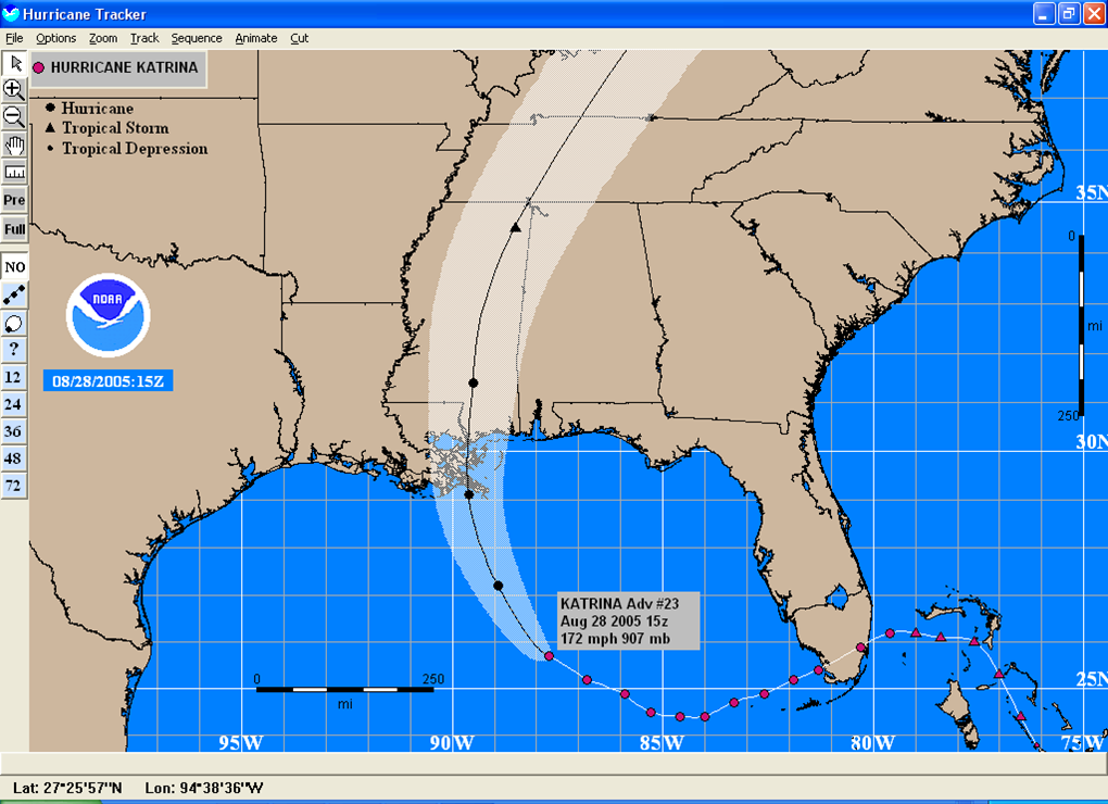
To account for the uncertainty of the wind and pressure forecast, it uses the official forecast from NOAA's National Hurricane Center (NHC) as well as NHC's historic 5-year average errors in track, size, and intensity of storms to create a collection of roughly 500-1000 representative wind and pressure inputs. An example of NHC's official forecast for Katrina 2005:
| P-Surge varies it based on cross track errors: | as well as errors in size, forward speed and intensity: |
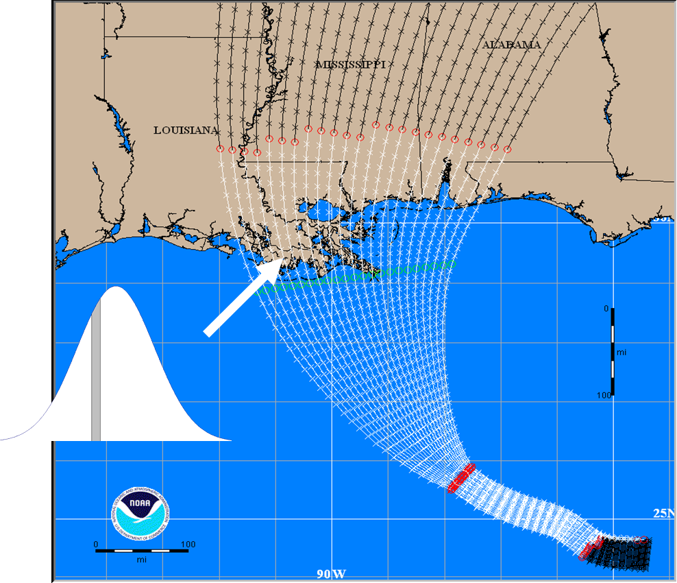
|

(*) This image predated the inclusion of tides. After including tides, the forward speed (along track) sampling was increased to 7 with each weighted 14% (1/7). |
After creating the sample inputs, P-Surge provides them to the Sea, Lake, and Overland Surge from Hurricanes (SLOSH) hydrodynamic model to compute water levels and inundation due to storm surge and tide. Note: as of 2023, for Puerto Rico and the U.S. Virgin Islands only, P-Surge's version of SLOSH is coupled to a near shore wave model allowing a wave component to be included.
Since each input represents a specific portion of the error space (defined by the 5-year average errors), P-Surge is able to create probabilistic products by combining SLOSH's water level outputs with the likelihood of each representative input in a well defined statistical manner. The results are merged onto a uniform grid and the result are probabilistic products that are consistent with NHC's message.
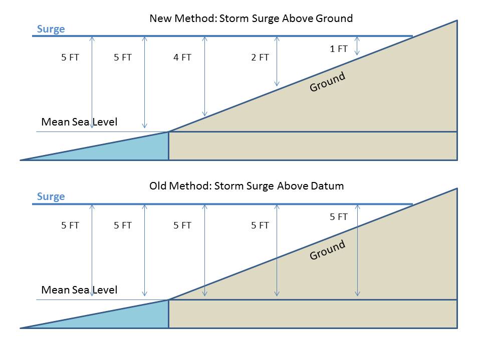
The hydrodynamic model within P-Surge computes water levels above a vertical datum, or zero point. In the case of SLOSH that is currently NAVD-88 for the contiguous US, or island datum for Puerto Rico and the US Virgin Islands. While this uses a well defined scientific reference, it can be challenging to communicate to users when discussing water inundation well inland.
Consider the case of Hurricane Ike 2008. Near the coast line, the guidance above NAVD-88 and the water that people experienced above ground level roughly matched. This is because at the coast, ground level and NAVD-88 are roughly the same. The problem is that inland, ground can be say 10 feet above NAVD-88. So guidance of 15 feet above NAVD-88 is just 5 feet above ground. Unfortunately people unfamiliar with datums expected to see 15 feet of water.
To resolve this mismatch of expectations, P-Surge creates above ground level products in addition to above datum products. The difference in the products is illustrated below: